Rallye of Light
- Van Warren
After it was pointed out that we had built a portable observatory, I decided to take a journey - a virtual rallye of sorts. It all started with a question, "Where is the least light pollution?". It ended with unexpected insights and more questions. Maps turn out to be the stars of this show.
In
the light pollution map below many
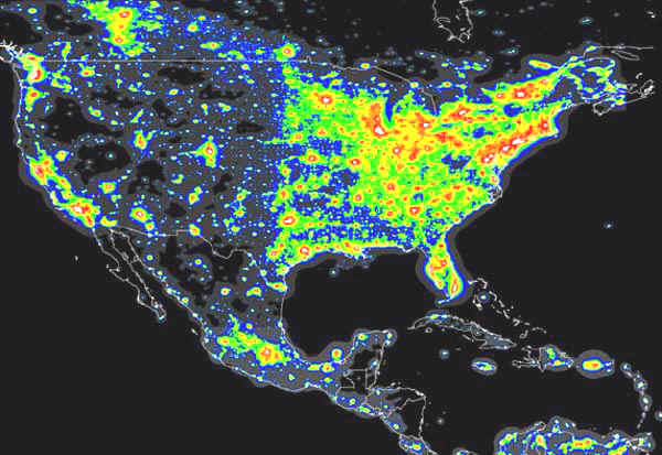

Can you hear frogs and the crickets out there? Maybe not.
The first two maps were combined to produce the next map. Colorful places are best. This registration isn't perfect, but it's a start. El Paso TX, Santa Fe NM, & northern Nevada look like possibilities. Curiously no locations east of the Mississippi remain with low light and high elevation.
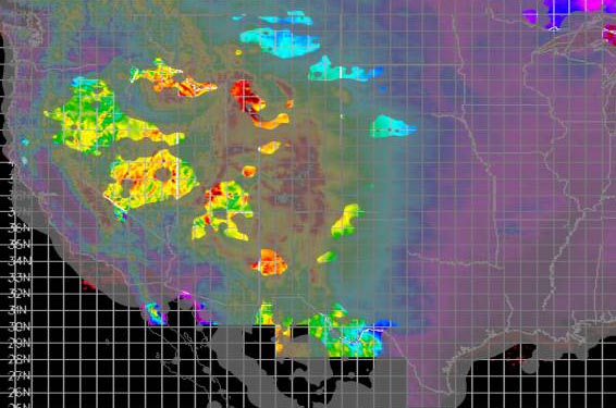

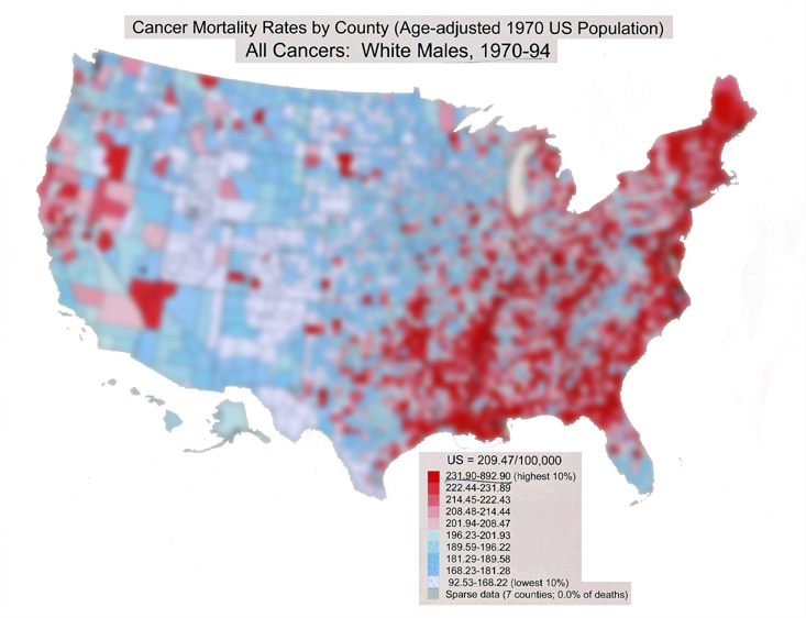
The purple zones flag high background levels of gamma rays from Uranium, Thorium, Potassium-40 and other natural sources. This made me wonder about cancer caused by natural background radiation. Florida has little of that. Another good reason to go there.The blacked out data dropouts are interesting. Mel Gibson and the CIA could check those out. The radiation map raises the question, "What is the cancer incidence in the high rad purple areas, compared to the rest of the country?" So this takes us in a bit of a scary direction.
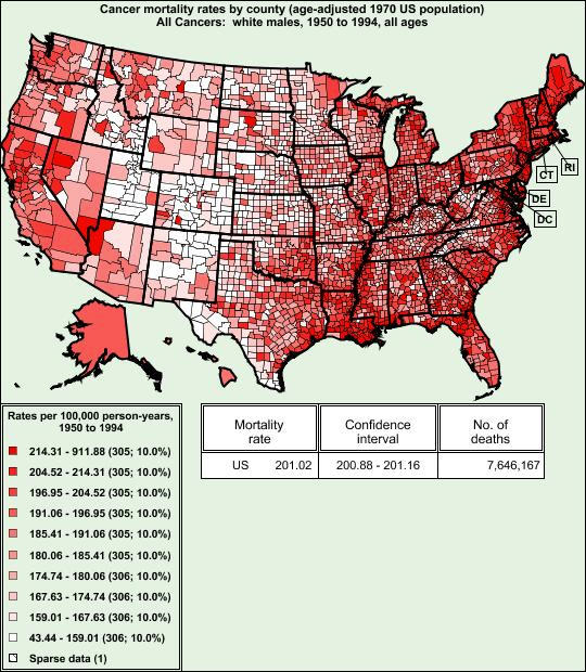
Here is a map of death by cancer, scaled by population for a 44 year period. There is some correlation with radioactivity, but it isn't huge. The Mississippi delta appears to be a worse source of cancer than naturally occurring radiation. Could some of the areas in the west where radiation abounds confer a protective effect on the population, providing "free" therapy? Maybe not. A region that refutes this is the south east corner of Nevada extending towards Southern California. Was there atomic testing there? Are there different isotopes present in the Las Vegas/Lake Mead/Kingman area? What is in Lake Mead? What is going on in the Mississippi delta? What about the Red River going through Louisiana and creating the bottom border of Oklahoma. The Red River and the Mississippi form a deadly 'V', terminating near Tulsa.
Pretend the United States is a piece of tissue being invaded by cancer. Where is it coming from. Where is the cancer most concentrated?. If Craig Venter can treat the oceans as a gene pool can we treat the US like a piece of meat? What is the distribution of cancer in that tissue? Slightly blurring a more recent map yields another view shown above. Coastal and river basin areas have high cancer rates. Does it have something to do with the water. Does it just correlate with urbanization, with pollution?


